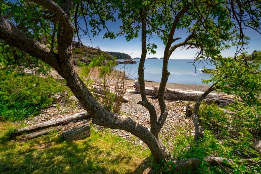
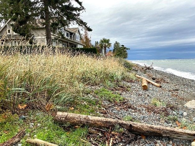
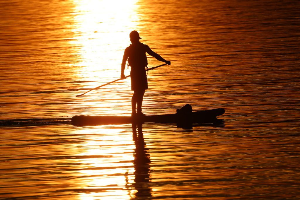
Shorelines represent the complex interface between land and water; a transition zone from the terrestrial to the aquatic. This zone provides critical habitat for coastal species including Pacific salmon, forage fish, and many others, and supports biological and physical processes that make the coast rich with life. Healthy shorelines nurture the coast in many ways, however they are threatened by coastal modification and impacts of climate change.
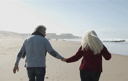
Tune into the webinar linked below to learn about the coastal risks of climate change, the drawbacks of using hard armouring on the shoreline, and how we can all be stewards of the coastal environment. Thank you to the webinar hosts: the Real Estate Institute of British Columbia. Click the image below to access the webinar recording, and use code #0*lgfJq.
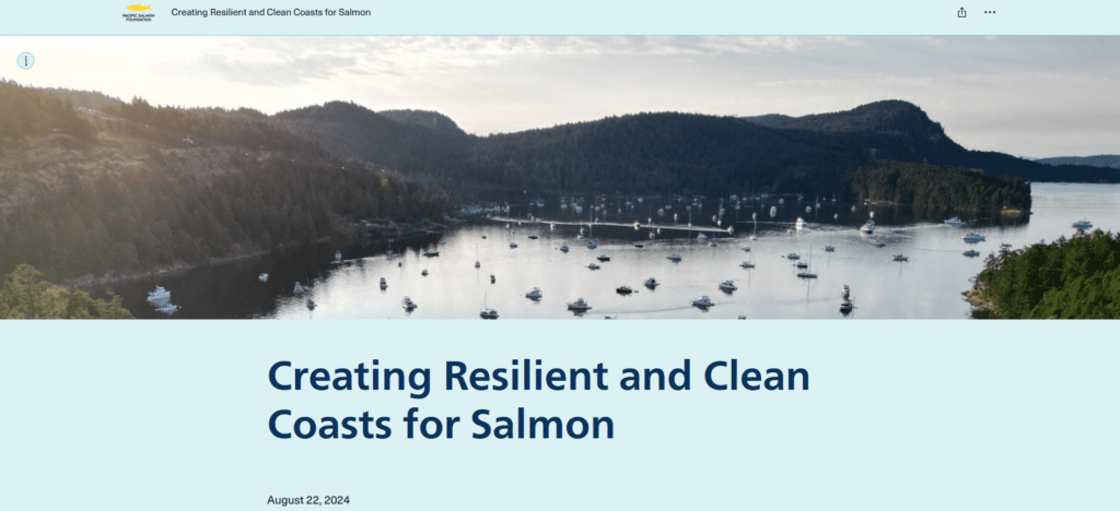
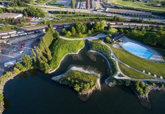
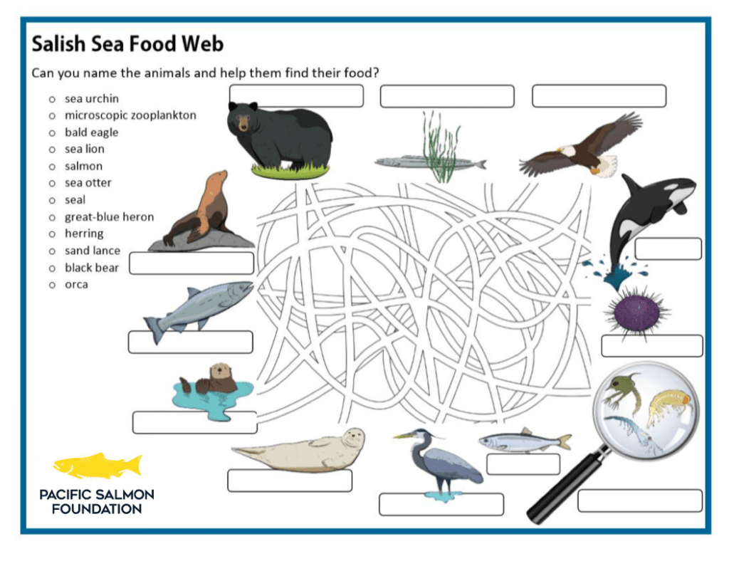
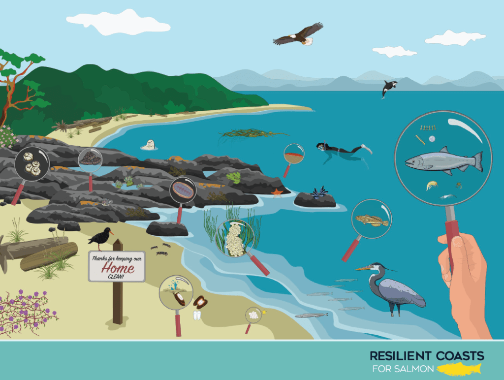
Creating Resilient and Clean Coasts for Salmon
Shorelines are vital to the health of Pacific salmon and other species of the coastal food web. They are complex areas where the land meets the sea, but sadly they are being impacted by coastal development, industry, and contaminants.
In the StoryMap linked below, join us for a walkthrough of why these habitats are so crucial in supporting the coastal ecosystem, how human-made features make our coasts more vulnerable to climate change and reduce habitat availability for many species, including Pacific salmon, and how the Resilient Coasts for Salmon project is making a difference. Follow along for tips about reducing your impact on coastal waters, whether you are a boater, a gardener or a coastal community member.
Click the image below to explore the first Resilient Coasts for Salmon StoryMap.
Five Surprising Benefits of Nature-based Shorelines
Have you ever thought about the unique benefits of natural and nature-based shorelines?
Both provide us with much more than just a pretty view. In fact, they offer a variety of ecosystem services that are crucial not only for the environment but for us human folk, too!
Firstly, what are Ecosystem Services?
Ecosystem services are benefits provided by natural environments and processes. These can include ecological benefits and benefits to people. Most healthy ecosystems provide multiple benefits!
Here are some examples of ecosystem services that shorelines can provide:
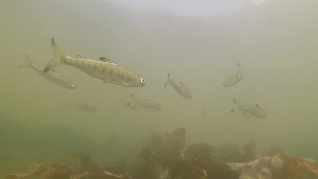
Habitat for Wildlife: Natural shorelines planted with native vegetation, including grasses, shrubs, and trees, provide vital habitat for a diverse array of wildlife. They offer shelter, nourishment, and breeding grounds for many creatures, including forage fish, an important food source for Pacific salmon and the greater aquatic food web.
Temperature Regulation: Trees and other vegetation on the shoreline regulate local temperatures. They create a natural air conditioning effect through transpiration and evaporation, making the area cooler. Shade from overhanging trees can also provide a thermal refuge for aquatic life sensitive to high temperatures. In winter, vegetation can provide a buffer from chilly winds and stormy weather.
Water Purification: Native plants along the shoreline serve as nature’s water filters. When stormwater rushes toward the coast, these plants intercept it, trapping pollutants and preventing them from entering sensitive waterways. Cleaner water benefits both the environment and human communities.
Enhanced Resiliency to the Effects of Climate Change: Natural and nature-based shorelines often feature gently sloping foreshores planted with intertidal vegetation, like seaweeds and grasses. These work together to buffer wave energy and enhance the shoreline’s resiliency to powerful storms.
Potential to Sequester Carbon: Vegetated areas, such as marshes, eelgrass meadows, riparian zones can sequester carbon, contributing to climate change mitigation.
Support the Economy: Healthy natural and nature-based shorelines offer desirable recreational areas and support important fisheries making them important for tourism and primary industries.
You may have thought of the above ecosystem services before, but did you know natural and nature-based shorelines have individual and community health and wellness benefits?
Here are five more ecosystem services that might surprise you!
1. Safety and Security:
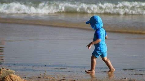
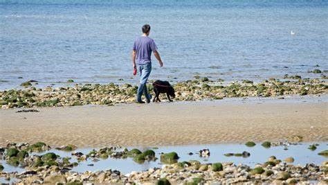
In addition to enhancing coastal resiliency to the effects of climate change, naturally sloped shorelines provide a safer space than seawalls for families, children, and pets. These beaches are a wonderful place for family members of all ages to explore the water’s edge and beyond without fear of toppling into dangerously deep water.
2. Mental Health:
Spending time in nature, whether in urban parks or forest trails, reduces anxiety, increases satisfaction, and improves mental health (1).
However, recent research has suggested that spending time in blue spaces may be even more beneficial than in green spaces. A 2016 study conducted in Wellington, New Zealand, suggested that even spending time within sight of “blue environments,” like the seashore, is associated with lower levels of psychological distress, especially among city dwellers (2).
3. Physical Health:
Walking on sand and pebbles, balancing on logs, climbing boulders, and jumping from stone to stone provide physical health benefits, including improved muscle tone and balance for the young and old alike. Exposure to nature can reduce blood pressure, muscle tension, and stress hormones (3). A day at the seaside is also an excellent opportunity to soak up some vitamin D, which helps to boost your immune system (4). Should your adventures take you into the water, you may also get a mineral boost since trace minerals from seawater can be absorbed through the skin.
4. Neurological Health:
Many of the characteristics of natural shorelines that boost our mental and physical health can also benefit our neurological health.
Spending time at the beach has been proven to regulate our nervous system, improve cognitive performance and mental clarity, and enhance creativity (5). Walking on uneven surfaces like pebbles and sand can give your brain novel sensory information, prompting motor learning processes and stimulating neuroplasticity (6).
5. Improved Learning Outcomes:
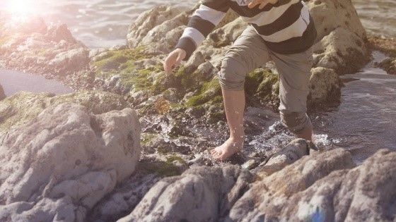
Whether playing in tidepools or investigating who lives among the grasses, rocks, sands, and shrubs, natural shorelines provide countless opportunities for experiential learning, building social connections, fostering independence, and engaging in sensory play. Since blue spaces have a calming effect on the nervous system, reduce stress and promote relaxation, they can greatly enhance your capacity for attention and engagement (7). Beaches also provide space to closely observe natural rhythms, like the tides, seasons, and life cycles of creatures like Pacific Salmon. People of all ages can benefit from acquiring shoreline knowledge and skills, such as identifying wildlife and foraging for seaweed, mussels, and clams.
So, the next time you're planning a day at the beach, consider the benefits of a natural shoreline. By conserving or restoring these ecosystems, we can protect the environment, enhance recreational opportunities, and improve our well-being
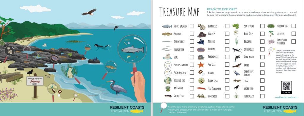
Visit our Kids Corner for fun and educational resources. See how many plants and animals you and your little one can find on your local shoreline with our Treasure Map!
Weir, K. (2020, April 1). Nurtured by nature. Monitor on Psychology, 51(3). American Psychological Association.
Nutsford, D. et al. (2016) Residential exposure to visible blue space (but not green space) associated with lower psychological distress in a capital city. Health & Place, Volume 39, P 70-78.
Jimenez MP, DeVille NV, et al. (2021) Associations between Nature Exposure and Health: A Review of the Evidence. Int J Environ Res Public Health.
Ao T, Kikuta J, Ishii M. (2023). The Effects of Vitamin D on Immune System and Inflammatory Diseases. Biomolecules. 2021 Nov; 11(11): 1624
1MD. Why Science Supports a Beach Day for Brain and Mental Health Benefits. 1MD Nutrition™
Hawkins KA, Clark DJ, Balasubramanian CK, Fox EJ. (2017) Walking on uneven terrain in healthy adults and the implications for people after stroke. NeuroRehabilitation.
Bratman, G. et al. (2019) Nature and mental health: An ecosystem service perspective. Science Advances 5,eaax0903(2019).DOI:10.1126/sciadv.aax0903
Shoreline Slope Restoration Project
Kristen Miskelly (Biologist and co-owner of Satinflower Nurseries), Andy MacKinnon (Forestry Ecologist, author, and former Metchosin Councillor), and Tayler Krawczyk (Co-owner of Hatchet & Seed) invited the Resilient Coasts for Salmon team to learn about a shoreline slope restoration project near Witty’s Lagoon, British Columbia. Tayler utilized a regenerative restoration technique called willow wattle fencing - whereby cuttings from willow trees are sustainably harvested in the dormant season and used to stake along terraces - for quick growth and stabilization of the slope. Learn how this project came about and the process it takes to use a nature-based approach to managing erosion on the shoreline.
Tour of a Native Plant Nursery and Coastal Native Plants
Join Kristen Miskelly on a virtual tour of Satinflower Nurseries and Witty’s Lagoon to explore the native shoreline plants of Vancouver Island! Kristen shares with us how riparian and estuarine vegetation supports healthy ecosystems and how you, as a gardener or restoration practitioner, can enhance the ecological value of a shoreline with native plants.
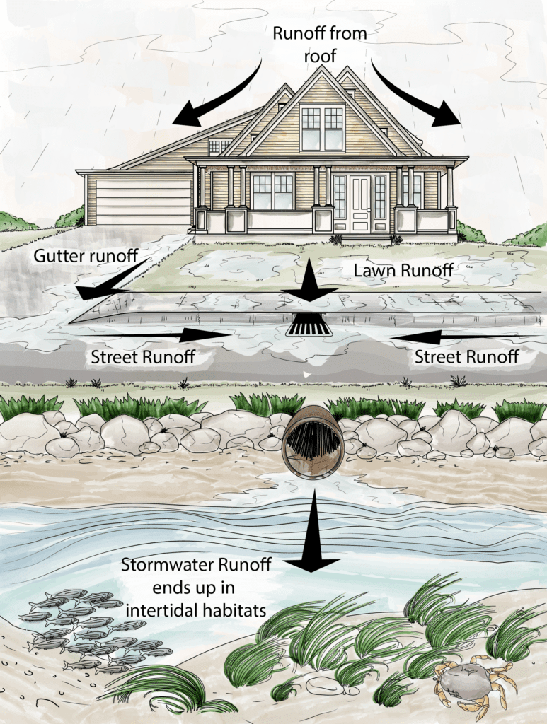
Nature-based Solutions to Manage Stormwater Runoff
Stormwater is rain or melting snow that is not absorbed into the ground.
In nature, trees and soil help absorb water slowly. This helps break down pollutants and refill groundwater, which keeps waterways and our shorelines healthy. Stormwater management is the effort to manage runoff of rainwater or melted snow on streets, lawns, and other sites and the contaminants carried along with it.
Why Manage Stormwater?
Uncontrolled stormwater can negatively impact our lives and the environment in many different ways. It can contribute to flooding, which can damage infrastructure and endanger human lives. Stormwater runoff can also contribute to issues of erosion, leading to widening of streambanks, and failure of slopes. Stormwater washes contaminants and sediments into aquatic environments, degrading them. And, as the name implies, runoff moves over surfaces and does not infiltrate the soil, therefore it does not contribute to refilling groundwater.Groundwater is important as a source of potable water and for its contribution of cool, clean water to the base flows of streams during the warm dry season.
Managing stormwater can reduce flooding and property damage and improve the quality of water entering aquatic environments, including streams, rivers, and shorelines. Water absorbed on-site, through permeable surfaces such as a garden, special pavers or natural areas, helps to maintain groundwater stores and soil moisture, benefiting vegetation, including flower and vegetable gardens. You may even harvest excess rainwater in a tank to use at times of the year when water is in shorter supply.
What is an impervious surface?
Impervious surfaces are hardened areas where rainwater cannot infiltrate into the ground. They can be made up of materials like metal, concrete and asphalt. Rainwater falling on impervious surfaces flows to stormwater drains that are often directly connected to streams, rivers, or the nearshore environment. During a storm, water that flows off impermeable surfaces may move very quick, much faster than it would naturally, and that can lead to erosion, flooding or ponding. Stormwater runoff can be a problem in towns and cities, since there are lots of impervious areas in the form of roofs, paved areas, and roads.
The illustration shows the movement of water runoff to the shoreline via paved surfaces and storm drains, which typically connect directly with waterways or the ocean. Illustration by Ravi Maharaj and Holly Sullivan.
What are the Contaminants in Stormwater Runoff?
As stormwater flows over impermeable surfaces, it collects debris and pollutants. Many of these contaminants have major impacts on our coastal ecosystems and human health. Let’s take a closer look at some common contaminants!
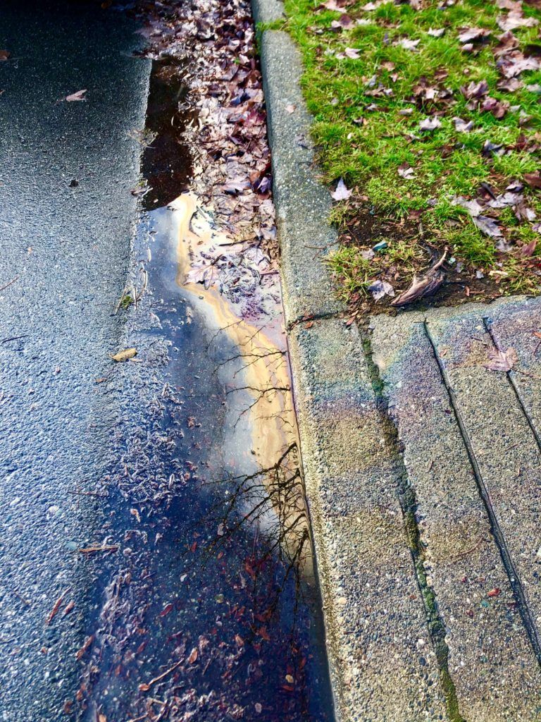
Road and Surface Contaminants
Oil and residues that can be found on driveways, streets and highways can be extremely harmful to aquatic environments. One example of a particularly concerning contaminant that moves into aquatic systems from roads is the compound used as an antioxidant to reduce tire wear, 6PPD-quinone. This compound flows from roadways, through surface runoff, into water courses. It is extremely toxic to fish and is lethal to coho salmon. Learn more about this nefarious contaminant from the Nature Conservancy.
Excess Nutrients
Did you know that nitrogen and phosphorus are often found in large concentrations in runoff?
Nutrients such as these often originate from chemical fertilizers and animal waste (manure) that is applied to agricultural lands or gardens. While animal manure and compost are often a part of a healthy closed cycle agricultural operation, in large scale commercial operations, manure and chemical fertilizers are often applied in excess. During rain events, the nutrients that are not bound in the soil or plant parts will be washed away over the soil surface.
When excess nutrients enter our waterways, they can feed the phytoplankton and algae that live in those waters. While this may sound like a positive effect, the sheer amount of those nutrients can trigger larger areas of algae to bloom all at once. When these algae complete their life cycle and die, they decompose into the water column, a process which consumes oxygen. This can leave our waters de-oxygenated and inhospitable to aquatic life, or eutrophic. You can do your part on your property by planting native plant species that require little to no inputs of nutrients to grow and thrive. You can learn more about nutrient runoff issues and how land managers can help to reduce their contribution of nutrient pollution in this article from the U.S. Environmental Protection Agency.
Garbage
During major rainfall events, the flow of stormwater across impervious surfaces can be strong – it can even be strong enough to pick up litter like plastics bags, bottles and single use cups and carry those debris out to nearby waterways. Over time, this litter breaks down into smaller and smaller particles, but the plastics in these materials remain in the environment as microparticles, which are still detrimental to aquatic life. Plastics consumed by wildlife disrupt feeding and growth by physically filling their stomachs without providing nutrients. As their bodies attempt to break down these materials, it can result in bioaccumulation of toxins in their tissues.
Learn more about microplastics pollution and how to reduce your contribution through your laundry and clothing choices in this Tool Kit article.
Other common contaminants include suspended sediments, pet waste, herbicides, and pathogens that could be dangerous for human health. Learn more about the most common stormwater contaminants and their potential impacts in this page of the Minnesota Pollution Control Agency’s website.
Steps to Manage Stormwater at Home
We can embrace nature-based solutions to help manage the rate, amount, and direction of stormwater. Also referred to as Low Impact Development (LID), nature-based solutions allow rainwater to filter into the ground, reducing contaminants from runoff before entering receiving water bodies. Here are six techniques you can try out:
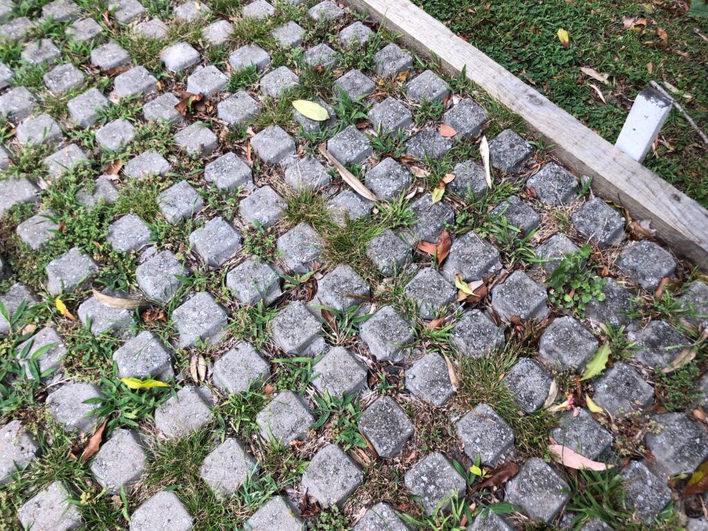
Increase permeable surfaces by installing permeable pavers, gravel, or grass that allow water to be absorbed on-site rather than concrete paving. By adding space between paving stones where the water can infiltrate the soil, we can reduce the total area of impermeable surfaces and the amount of runoff leaving our properties. Learn more about permeable paving stones through the Green Building Alliance.
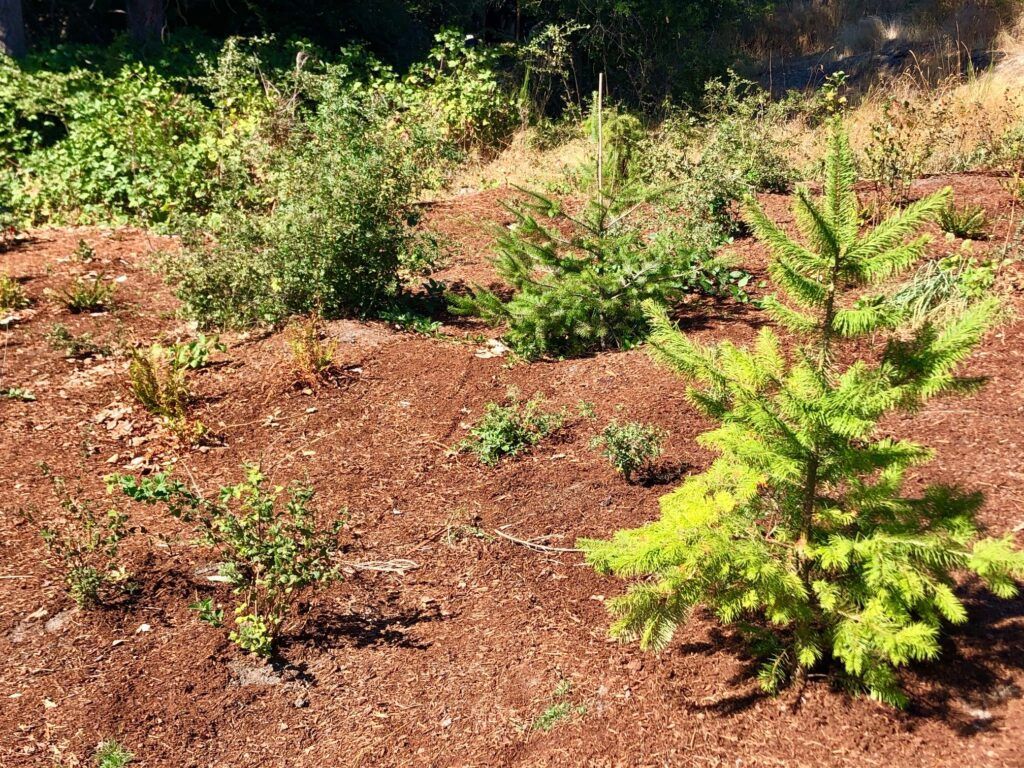
Plant and maintain vegetation, such as trees and shrubs. The canopy of leaves and branches can protect soil surfaces from erosion by intercepting falling rain during intense storms, and the roots help to hold onto the soil. Remember that messy is beautiful and a diverse garden will have many benefits, including storm water management. If you are concerned about viewing opportunities from your property, native shrubs are a great option to retain soil cover while not obstructing views.
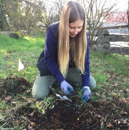
Wherever possible, choose native plants well adapted to the site. Native species will require little to no input of fertilizer or herbicides, resulting in a lower impact on nearby waterways.
Look out for plants that not only absorb water but clean it, too. Some sunflower species are phytoremediators, meaning they can remove heavy metals like zinc and copper from soils. Try out these other phytoremediators suggested in this Basmati article.
Support healthy soil and increase water absorption on your property by adding mulch such as grass clippings, wood chips, leaves, and other organic materials.
In addition to absorbing water, healthy soils help clean it, too – did you know that there are microbes in the soil that help with the bioremediation of contaminants? There are microbes that naturally are a part of the soil doing this work all the time, but bioremediation can be used on a large scale with powerful to help clean up things like oil spills.
Consider a green roof. Green roofs have a waterproof membrane, growing medium, and soils that support living plants and are designed so that the weight of the soil and plants is less than or equal to the weight the roof structure can safely support. According to the Stormwater Center, green roof can reduce annual runoff by 50 to 60%.
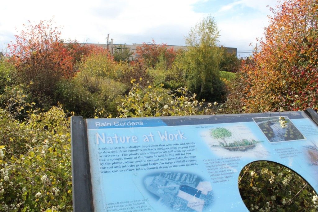
Install a rain garden or bioswale to retain and absorb water runoff from roofs. A rain garden is specially designed to treat stormwater runoff. It works by collecting water in a sunken garden space planted with native species, which allows the water to infiltrate through a constructed soil layer to the native soils below.
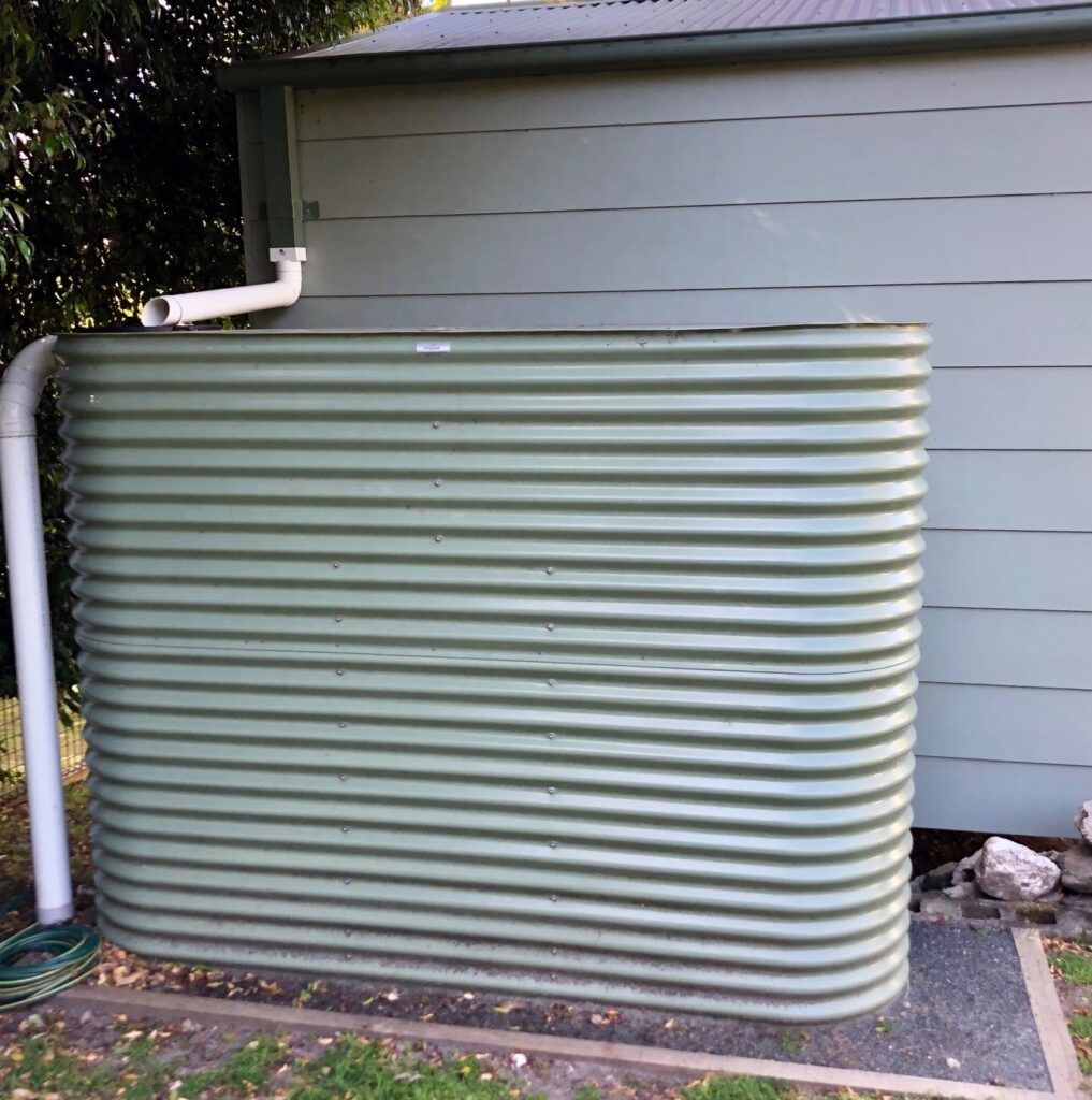
Reduce runoff from your roof by using a rainwater harvesting system. Stored rainwater can be used for garden irrigation, washing your car, and other uses around the home. More information on rainwater harvesting can be found within the Regional District of Nanaimo’s comprehensive guide for best practices and the Capital Regional District (CRD), which includes a list of suppliers for rainwater tanks and other tools to help create a rainwater harvesting system that will work for your property.
When considering what nature-based stormwater management techniques will work for you, take the time to understand how your property interacts with runoff. Notice where water runs over impermeable surfaces, where it originates, and where it goes. This knowledge can help guide what actions will be most beneficial on your property and where those actions should be applied.
For example, a riparian area or meadow filled native plants, such as camas lilies shown below, can provide a buffer between the upland and shoreline, slowing and treating water runoff before it enters a waterway.
Stormwater Management and Your Community
Applied on a larger neighbourhood scale, the benefits of stormwater management can be significant. Check out these examples of green roofs, rain gardens, and other runoff management infrastructures that have been successful in Metro Vancouver, Victoria, and Seattle. Nature-based solutions can be used on all scales of projects, from your front garden to municipal park restoration! in any case, using Green Stormwater Infrastructure can help to capture and slow the flow of water, clean stormwater from pollutants, and store and convey stormwater to reduce flooding.
Check out these local stormwater management projects. On the left below, is a stormwater management project by BC transit (handyDART) and Salmon Safe at Craigflower Creek in Victoria. It includes nine rain gardens that help filter contaminants and a series of weirs and pools to help mitigate the flow of runoff from the nearby highway. This incredible project will help reduce the impacts of runoff into Craigflower Creek, an important waterway for Pacific Salmon, waterfowl, and amphibians. The project is built to process runoff from even a 200-year rain event! On the right is a recently installed local rain garden by Peninsula Streams and Shorelines (PSS) in partnership with school district 61 in Victoria. The rain garden basin will help collect runoff from the school’s paved surfaces; native plants will soak up water, filtering out the contaminants that might otherwise flow into waterways.
It is important to remember that application at the homeowner scale matters. Using some or all of the above techniques supports homeowners and the environment in managing stormwater. Using the Green Shores for Homes guide also can help, learn more about Green Shores in this article. With Green Shores for Homes, you get credit for reducing impermeable areas, retaining rainwater for household and landscape use, and for maximizing areas of vegetation and absorbent landscapes. By working with a qualified professional and using Green Shores for Homes and local stormwater design guidelines, a system can be developed to protect properties from the extreme precipitation events expected with climate change. With stormwater, every drop counts!
Resources:
The CRD website has a number of helpful pages for managing stormwater, such as this page about preventing stormwater pollution.
Photo credits: Luke Southern on Unsplash; Nicole Christiansen; Liz Harrell on Unsplash; Yogendra Singh on Pexels; Maria Catanzaro; Lehna Malmkvist; Kelly Loch.
How Green Shores Help Salmon
Green Shores certification can help homeowners and shoreline developers restore, protect and maintain natural shorelines while providing benefits to salmon and other wildlife.
Green Shores® is a science-based program of the non-profit Stewardship Centre for BC that focuses on positive steps to reduce the impact of development on shoreline ecosystems and helps waterfront property owners restore natural shorelines and enjoy the many benefits they bring. Learn more about it in this post.
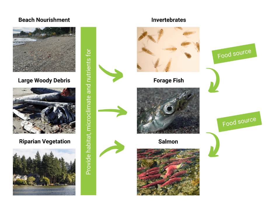
Rather than hard armour for shoreline protection - which can have detrimental impacts on salmon, properly designed Green Shores projects work with natural conditions and offer a suite of more desirable environmental outcomes. For instance, soft shore designs encouraged by Green Shores guidelines provide habitat for invertebrates which are the food sources for salmon, other fish species, birds, and marine mammals. In addition, beach nourishment with sediment may provide spawning or breeding habitat for forage fish species (e.g., Pacific sand lance, surf smelt) that are key sources of food for salmon.
Green Shores projects use beach nourishment, large woody debris and boulders, and native vegetation to improve shoreline function and resiliency and provide habitat, microclimate and organic nutrients to support habitat for invertebrates, forage fish and salmon.
Now, let's take a look at two examples of Green Shores projects and how they support salmon.
Example 1: Green Shores for Homes project near Qualicum Beach, BC
Before Restoration
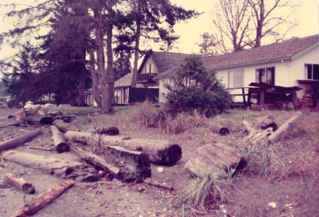
The site for this Green Shores for Homes project is located in the Parksville-Qualicum Wildlife Management Area, which protects over one thousand hectares of habitat supporting Pacific salmon and trout species (SNC Lavalin Inc, 2015). Historically, the entire Qualicum Beach waterfront had a gentle grade to the foreshore and a sandy beach suitable for forage fish spawning activities.
Historic photo of the nearby site (~1970s). Note a gentle grade to the foreshore and a sandy beach suitable for forage fish habitat (Provided by the Town of Qualicum Beach).
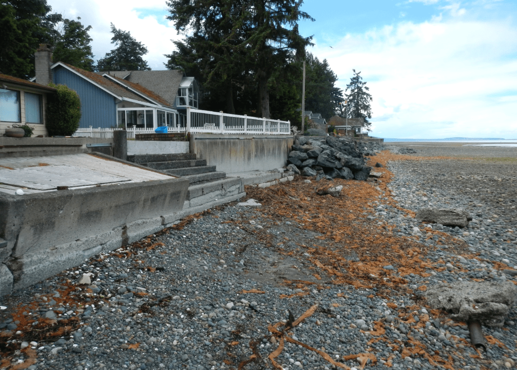
Over time, this shoreline was significantly altered by man-made structures, including concrete bulkheads, seawalls and rip-rap. These structures have limited the local supply of fresh sediment and reflected energy in the upper bench during storms, leading to the loss of critical habitat for forage fish. Waves were overtopping, properties were flooding, and the upper beaches were eroding.
The photo on the left was taken before the Green Shores for Homes restoration took place. Note the change of beach substrate to gravel and cobble, showing a loss of sediment compared to a historic photo of the site (above). In addition, the beach grade now “drops off,” making access to the shore more difficult, limiting shoreline vegetation establishment and reducing the habitat quality for forage fish.
Photo credit: Kelly Loch
Many nearshore fish and wildlife species need functioning high intertidal habitats as a source of food, migration corridors, cover, micro-climate effects, and spawning habitat. To improve natural processes and nearshore habitat conditions, it was most beneficial to remove existing hard armour from an armoured waterfront property and apply a nature-based Green Shores design. In 2020, the homeowners began a restoration project to address the negative impacts of pre-existing hard armour
The Green Shores for Homes Restoration
As part of the restoration design process, it was noted that the estuary of the Little Qualicum River, located within the 2 kilometres of the property, supports a number of salmonid species, including chum, coho, Chinook, pink and sockeye salmon, kokanee, brown, bull, rainbow, steelhead cutthroat trout, and Dolly Varden trout, as well as bass, sunfish, lamprey, and threespine stickleback.
In addition, out-migrating salmonid smolts use nearshore habitats such as that fronting the subject site. Hence the restoration work needed to help improve and enhance the habitat for forage fish and salmonids and address concerns like rising sea levels and coastal erosion at the site.
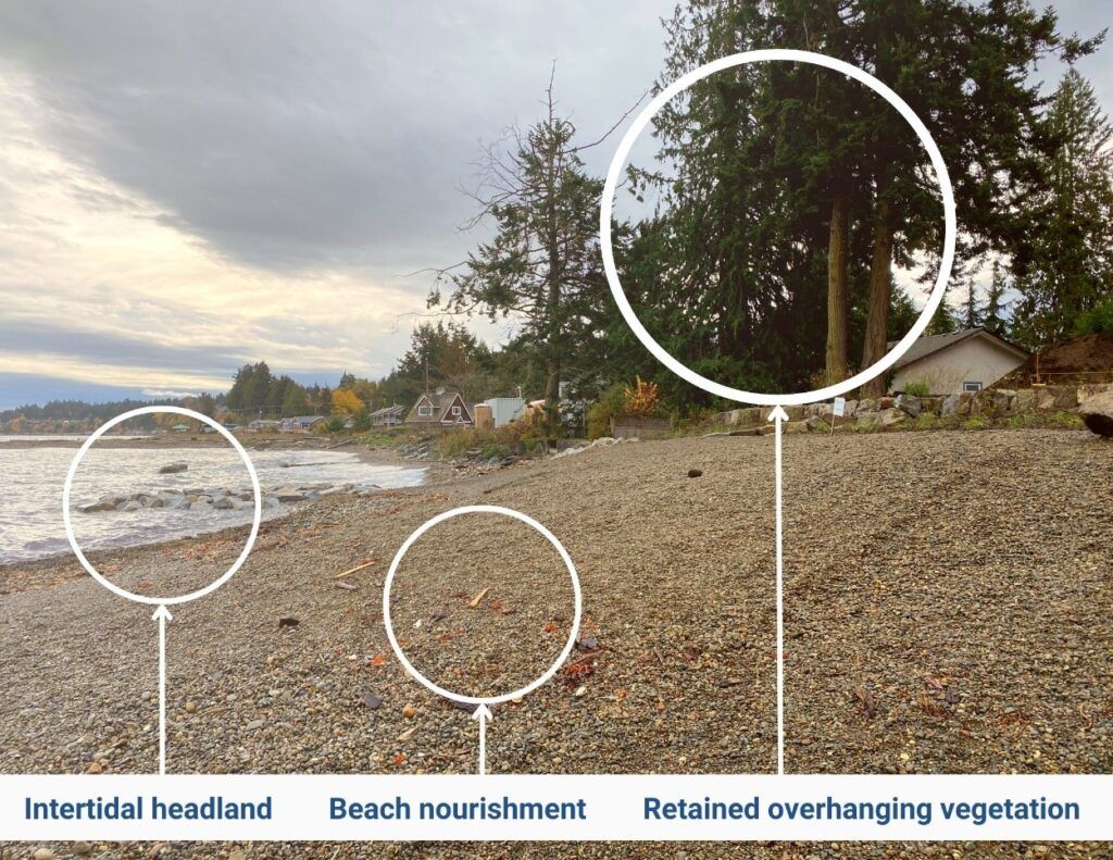
Installation of headland structures - in place of the seawall, large boulders were added to support longshore sediment movement, provide erosion protection, and offer a more diverse three-dimensional habitat for algae and intertidal species.
Beach nourishment - a sand/gravel mix was used for the lower and offshore regions of the beach fill to provide erosion protection of the site along with enhanced habitat opportunities to support nearshore and beach spawning species such as sand lance, surf smelt, and Pacific herring.
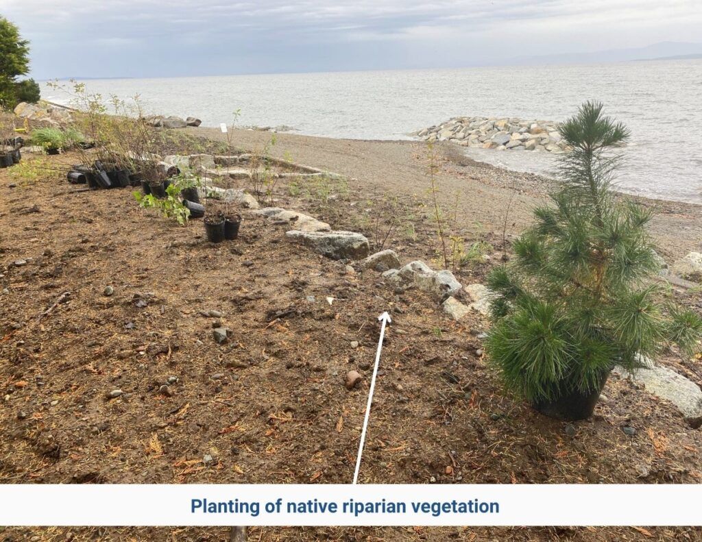
Riparian restoration - overhanging vegetation that provides food and climate regulation for fish was retained. The vegetation remediation plan included planting of native trees, shrubs and groundcover species.
Removal of invasive plant species - weeding out invasive plants was undertaken to provide a healthy environment for all wildlife, including salmon and other fish.
All project activities were scheduled and completed to accommodate fisheries windows - planning was timed to avoid herring spawning in this area from mid-February to mid-April.
An Environmental Management Plan for Construction - Contractors used equipment that was clean and free of leaks to prevent contaminants detrimental to salmon from entering the riparian and aquatic environments.
Photos of the restoration project showcasing nature-based solutions used as part of the GSH design: 1) intertidal headland that provides habitat for intertidal species and breaks up incoming waves, 2) beach nourishment essential for shoreline stability and forage fish, 3) overhanging vegetation and 4) planting of riparian plants to provide cover, soil stability, organic input, filtration and temperature regulation on site. Photos credit: Kelly Loch
The Green Shores for Homes design has increased protection of the infrastructure and created a healthy, resilient shoreline environment that is free of contaminants but full of organic input and substrate for forage fish, salmon and other wildlife.
The project from the perspective of a homeowner:
“We worried about our waterfront property whenever a storm was forecast because our concrete and rock seawall, which had been installed before we bought the property, was failing. The beach in front of it had significantly eroded and our experience has been that more frequent and stronger storms are often overtopping it… The new design has much better protection from storms. The November 2021 and January 2022 storms that hit the west coast were so intense that they destroyed well established seawalls in Stanley Park. These storms also destroyed seawalls and caused coastal flooding in our community on Vancouver Island but our property fared extremely well and the waves didn’t even reach my property line.
Best of all, extensive habitat has been created and we see new life all the time. Beach grasses are starting to grow, sea life is returning, and sandy tidal pools are starting to form.”
– Qualicum Beach GSH homeowner, 2022
Example 2: Green Shores for Shoreline Development Project New Brighton Park, Vancouver, BC
Before Restoration
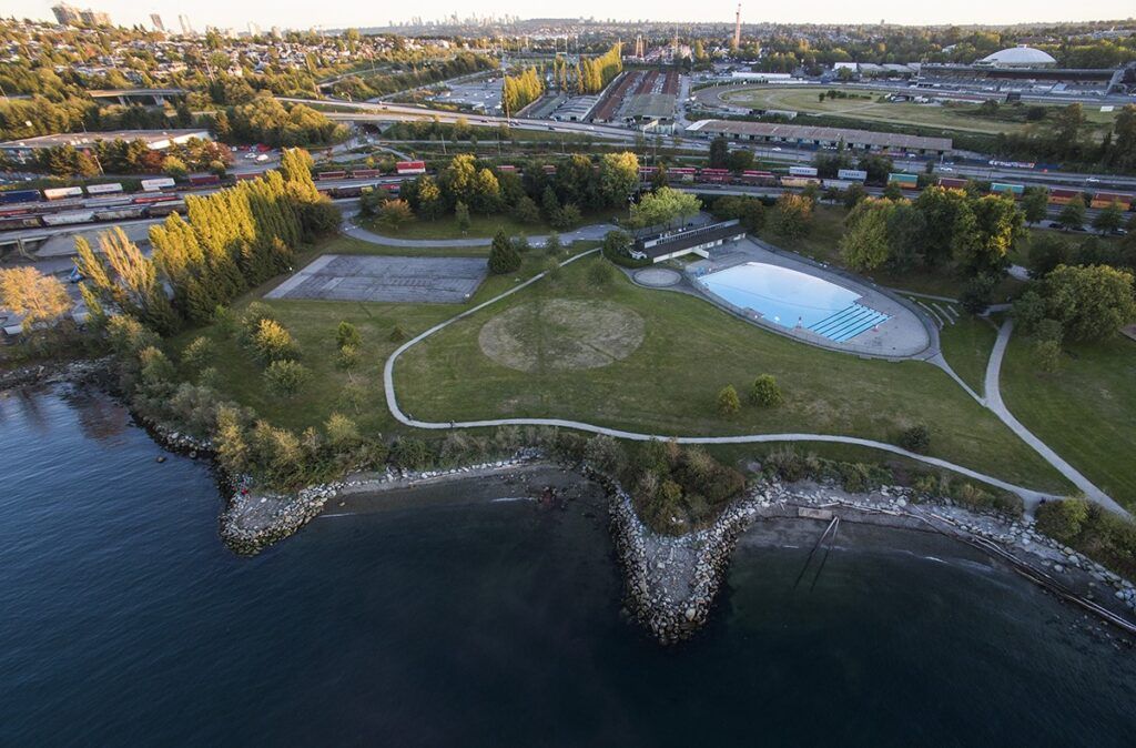
The New Brighton Park Shoreline Restoration Project transformed what was formerly part of an industrial harbour into a restored coastal lagoon and marsh system. The project intended to address the high mortality of juvenile fish migrating through Burrard Inlet by creating shoreline habitat and restoring tidal influence to support juvenile Chinook and chum salmon rearing.
The project site is located along the south side of Burrard Inlet immediately west of the Second Narrows Bridge in Vancouver, B.C. This site and nearby coastal areas have been used by Indigenous Peoples for millennia.
In the 1930s, the park was established in an industrial harbour. Thirty years later, in the 1960s, extensive filling of the intertidal zone occurred in the north portion of the park, shifting the shoreline by 150 metres and reducing intertidal, backshore and marine riparian areas. These changes negatively impacted native vegetation and shoreline habitat, leading to high mortality of juvenile Chinook and chum salmon migrating through Burrard Inlet.
New Brighton Restoration Project before GSSD. Photo from Green Shores for Shoreline Development Ratings and Credits Guide.
The Green Shores for Shoreline Development Restoration
Because of its location within a high-use urban environment, extensive consultation was completed before development, including public consultation and collaboration with the šxʷməθkʷəy̓əmaɁɬ (Musqueam), Skwxwú7mesh-ulh (Squamish), and səl̓ilwətaɁɬ (Tsleil-Waututh) First Nations. Based on this consultation process and to meet Green Shores for Shoreline Development certification and Prerequisites, the following were key parts of the restoration design:
Restoration of coastal wetland habitat - the tidal influence was restored as was the channel and Hastings Creek was connected to the newly created saltwater marsh areas.
Creation of new riparian habitat - quality habitat was recreated along the creek channel.
Creation of additional intertidal habitat - the overall ecological function was improved for a critical area for juvenile salmon (chum and Chinook) and for resting and feeding shorebirds.
Enhanced the presence of native vegetation - through the establishment of forest and shrub communities on the east side of the salt marsh and beach grass meadows and shrub thickets on the west side of the salt marsh with an extensive planting program, including the installation of about 25,000 salt marsh plugs, 200 native trees and 4,000 coastal shrubs.
Sediment and erosion controlled during construction - including prevention of construction-related soil loss and reduction of sediment input to the receiving environment from construction-related run-off and stormwater.
New Brighton Park after restoration – Gold Certification. Photo from Green Shores for Shoreline Development Credits and Ratings Guide.
The Green Shores for Shoreline Development design in Brighton Beach Park created upper, mid and subtidal salt marsh areas and enhanced instream and riparian habitat for salmon species feeding along the shoreline of Burrard Inlet. The project also helped restore tidal influence, connected Hastings Creek and the newly created saltwater marsh areas, acting as estuaries for juvenile salmon, and protected sediment essential for salmon spawning. Creation of additional intertidal and riparian habitat with an additional 290 m of shore length increased the overall ecological function of a critical area for juvenile salmon (chum and Chinook) and for resting and feeding shorebirds.
“We are thrilled that we have been honoured—along with our partners—with this environmental stewardship recognition. The restoration of this beautiful place as an oasis of biodiversity in the urban environment is one of this board’s proudest achievements.”
- Vancouver Park Board chair, Stuart Mackinnon, 2018
Juvenile salmon using the wetland during the second spring season after connection to Burrard Inlet (May 2018).
Interested in getting help, guidance and certification with Green Shores for Homes or Green Shores for Shoreline Development project? Learn about the process in this Tool Kit article and discover more about nature-based solutions for shorelines here.
Bridges, T. S., J. K. King, J. D. Simm, M. W. Beck, G. Collins, Q. Lodder, and R. K. Mohan, eds. 2021. International Guidelines on Natural and Nature-Based Features for Flood Risk Management. Vicksburg, MS: U.S. Army Engineer Research and Development Center.
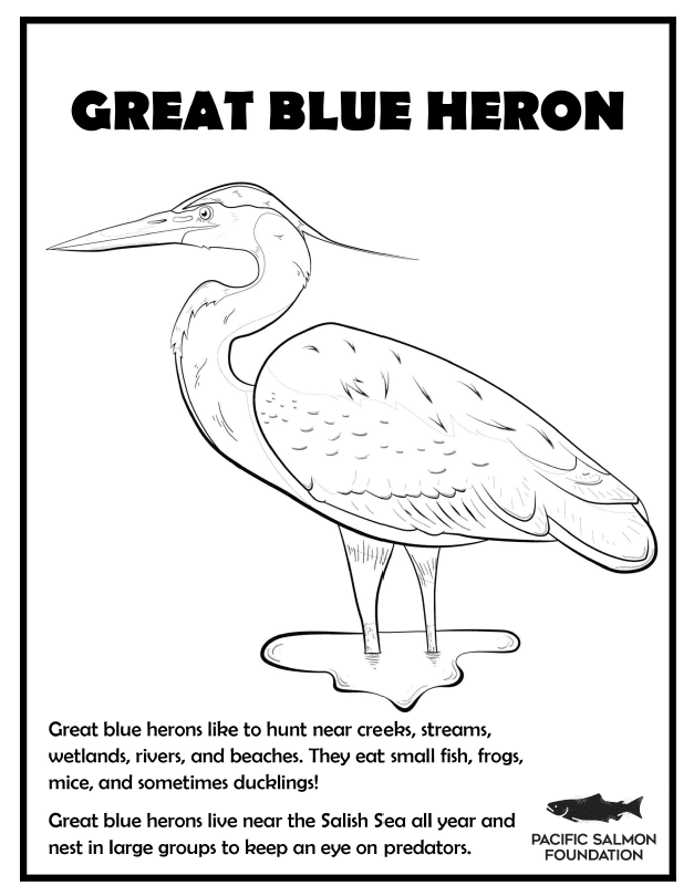
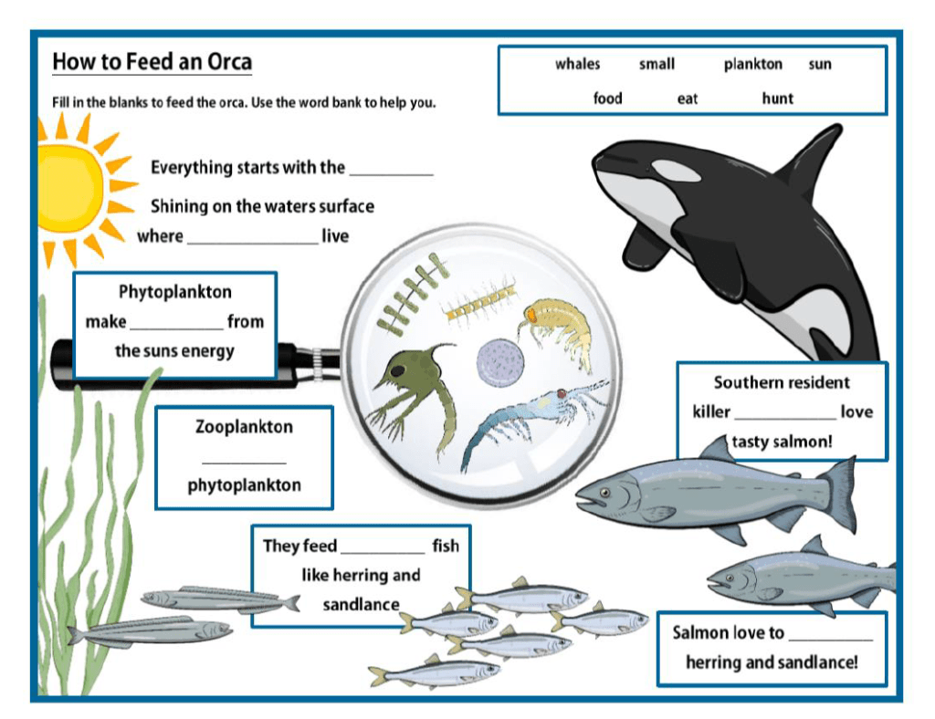
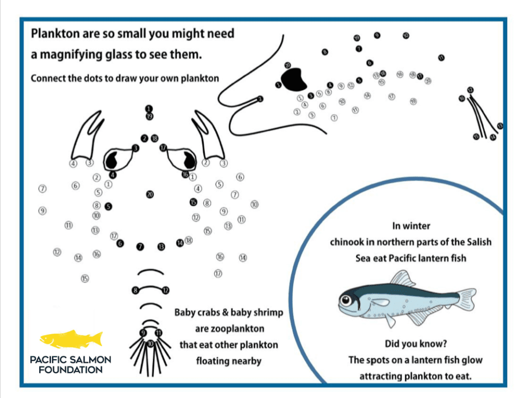
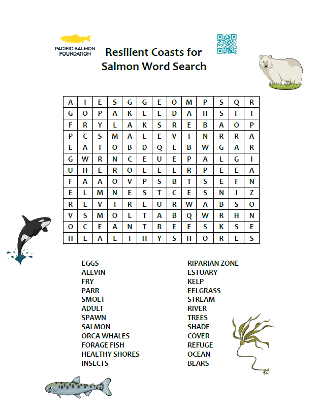
Here are some materials that we share at events that you can download to enjoy at home or on your next adventure to the shore.
Colouring sheets:
Activity Sheets:
Treasure Map
Interested in More Learning?
Pacific Salmon Foundation has online educational videos and worksheets targeted for different school ages in their Salmon School.
What is Green Shores?
Nature provides resiliency, Green Shores® can help you harness it.
Green Shores® is a program of the non-profit Stewardship Centre for British Columbia (SCBC) that encourages the use of nature-based solutions to promote healthy shore environments which provide economic, environmental, and social benefits for coastal communities.
Green Shores offers a framework of best practices, training, and technical support to property owners interested in applying nature-based solutions on their property.
Homeowner and Environmental Benefits of Green Shores
Green Shores is based on nature-based solutions for the shoreline that benefit both the homeowner and the terrestrial and aquatic environments.
By working with natural shoreline features such as riparian vegetation, large woody debris, shoreline materials (sand, cobble, and gravels) and natural processes (for example, sediment transport), Green Shores designs protect and make shoreline properties more resilient. Resiliency is key with the threats of climate change: sea level rise, storm surge, erosion and flooding. while also improving access to the shoreline and enhancing the aesthetic value of shoreline properties.
Green Shores projects are based on four important principles that benefit both the homeowner and the environment:
Preserving or restoring shoreline physical processes—the natural actions of water and sediment movement that maintain healthy shorelines.
Maintaining or enhancing habitat function and diversity along the shoreline.
Preventing or reducing pollutants entering the aquatic environment.
Avoiding or reducing cumulative impacts—small individual effects that add up to large impacts on shoreline environments.
With changing climate and increased use and development of shorelines, ecosystem-based approaches, like Green Shores for shoreline management, are increasingly important and valuable to shoreline homeowners and coastal communities. The Stewardship Centre for BC provides guidelines and support to homeowners interested in applying Green Shores nature-based solutions on their properties.
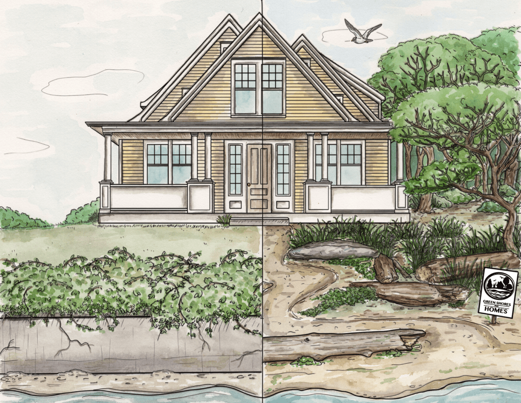
Resilient nature-based alternatives for shoreline protection
Conventional hard armour creates a barrier between the upland and riparian areas and prevents the essential transport of sediment along the shoreline. Green Shores nature-based solutions work with nature to allow for the natural movement of sediment while reducing the energy and impact of incoming waves, including the potential of erosion and flooding. In addition, Green Shores designs support biodiversity and habitat connectivity in all directions on the shoreline.
Conventional hard armour creates a barrier between the upland and riparian areas and prevents the essential transport of sediment along the shoreline. Rigid hard armour can also increase wave action and can be accompanied by erosion, threatening shoreline infrastructure.
Photo credit: District of West Vancouver
Green Shores nature-based solutions work with nature to allow for the natural movement of sediment while reducing the energy and impact of incoming waves, including the potential of erosion and flooding. In addition, Green Shores designs support biodiversity and habitat connectivity in all directions on the shoreline.
Green Shores nature-based solutions help lessen the impact of waves on the shore, support sediment movement and enhance floodwater infiltration thus protecting homeowners from floods and erosion. Photo of the Green Shores for Homes site in Qualicum Beach, credit: Kelly Loch.
Photo credit: Kelly Loch
Nature-based Solutions: cost-effective alternatives to protect shoreline infrastructure
Hard armour that includes riprap, concrete and wooden walls, is one of the most expensive practices that can be done on the shoreline, considering the cost of required materials and labour (Côté and Domanski 2019).
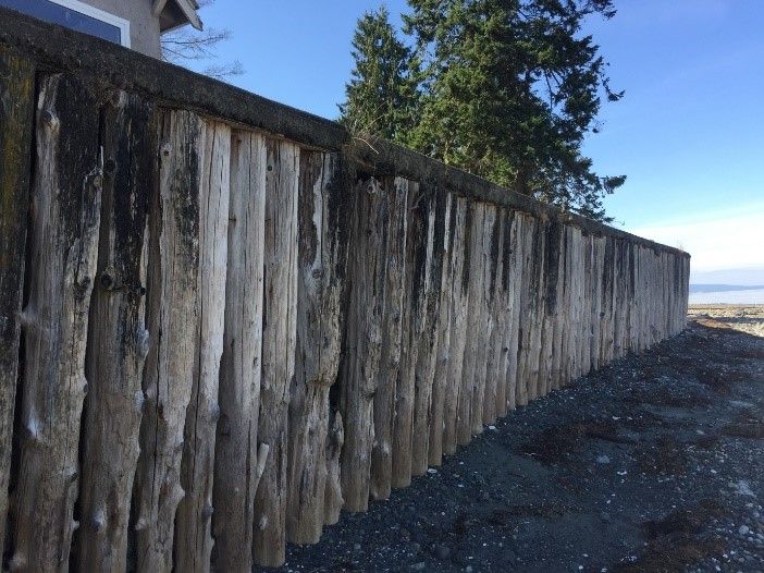
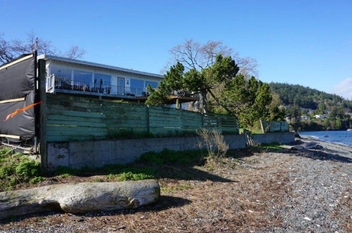
Examples of shoreline armour that separate the upland and riparian areas. On the right is an example of concrete wall armour and the image on the left shows wooden wall hard armour. Photo credit: Kelly Loch.
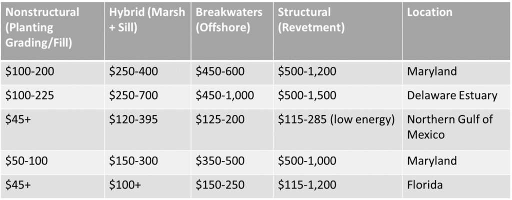
The least costly option is sustaining a healthy natural shoreline. It has been calculated that the average cost for hard armour installations is between $50,000-$60,000 USD per 100ft piece of shoreline; in comparison, soft shore installation is about half of that price, between $25-30,000 USD (Côté and Domanski 2019). Other estimates also demonstrate that hard armour is consistently more expensive than nature-based approaches, see the estimates provided in the table below.
Of course, all shoreline projects, including Green Shores, have associated costs such as permitting, consulting, design, engineering, biological studies and cultural investigations, as well as other expenses like materials, equipment, and labour (Côté and Domanski 2019). Homeowners are responsible for hiring consultants as needed, obtaining required permits, purchasing native vegetation and scheduling machine work on site if required by the project design. However, once installed, nature-based shorelines are adaptable to changing environment and extreme weather events, requiring minimum maintenance and helping save costs on flood control and flood damage, which can cost homeowners tens of thousands of dollars in repair (Moudark et al. 2018).
Nature-based shoreline solutions also provide a return on investments and economic benefit – both now and into the future. For example, property value with a natural shoreline may be increased due to the increased aesthetic value of the property, improved shoreline access, and enhanced ecosystem services like flood control, air, climate and water regulation, and pollution management (Eyzaguirre et al. 2020; Côté and Domanski 2019). In 2020, a two-year socio-economic assessment of the Green Shores for Shoreline Development program revealed that the nature-based Green Shores program provides a benefit-cost ratio of 7:1, such that each $1 invested in a Green Shores for Shoreline Development project generates $7 in a multitude of benefits including social welfare in BC (Eyzaguirre et al. 2020). Further, investments made as part of the Green Shores program have made noteworthy contributions to the BC economy by, for example, supporting 74 to 83 jobs (Eyzaguirre et al. 2020)
Additional benefits to shoreline biodiversity and human well-being
Green Shores nature-based designs also support biodiversity by creating and protecting habitat for both aquatic and terrestrial life, including amphibians, invertebrates, fish, birds, mammals, insects, and other wildlife, and enhance habitat with appropriate sediment for important intertidal species such as forage fish. Planting vegetation such as native shrubs and trees provides shade and temperature regulation during the summer and dead leaf matter and insects that drop from overhanging vegetation becomes a food source for invertebrates that sustain healthy soils and riparian and intertidal communities. Sediment, large woody debris and rocks provide spawning and foraging habitats for fish and migratory birds along the shoreline. In contrast, sea walls reduce the quality and quantity of habitat (Gittman et al. 2016).
In addition, healthy shoreline ecosystems provide recreational opportunities, aesthetic value, and spiritual and heritage values for adjacent properties, contributing to increased cultural significance and use of the shoreline (Eyzaguirre et al., 2020, Eyquem 2021). Natural shorelines are the source of raw materials that include food, water and medicine (Eyzaguirre et al., 2020). This is particularly important for direct consumption and future sustainable uses of materials found along natural shorelines.
Photo credit: Kelly Loch
Case study: Piper's Lagoon, Nanaimo
Green Shores assisted with coordinating a shoreline restoration project on a private property next to the City of Nanaimo's Piper’s Lagoon Waterfront Park. The site is located within an intact Garry Oak ecosystem and adjacent to a protected low-energy tidal flat, which is frequented by waterfowl and shorebirds. The main objective of the project was to remove the armouring and restore native riparian vegetation for a supportive and functioning foreshore environment.
Before
Prior to the restoration, there was an old concrete bulkhead with a fence along its top. This armouring significantly reduced shoreline function by interrupting the movement of materials and fauna between the upper and lower slope, and by impacting sediment transport along the shoreline. High tides would interface with the bulkhead, creating scouring along its edge.
Photo credit: Kelly Loch
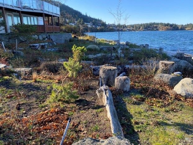
Actions taken
Approximately 24m of bulkhead and fence were removed along with an old buried, non‑functioning septic system allowing for the slope to be regraded to a more natural condition.
Lawn and invasive plants were removed and replaced with plantings of native riparian vegetation including dune grass, beach pea, gumweed and Nootka rose.
Several large rocks and pieces of large woody debris were placed throughout the newly designed riparian area creating protection against wave energy, micro‑habitat for flora and fauna, and increased aesthetic appeal.
Large overhanging Garry Oaks were retained, and other small trees (e.g. shore pine) were planted to help create sources of food from fallen leaf material and increase habitat connectivity.
Other cumulative impacts were addressed by replacing a paved driveway with pervious gravel to improve infiltration and reduce runoff and erosion impacts.
A roof rainwater capture system was also installed to mitigate runoff from the site and to help meet the property’s irrigation needs.
After
Tidal function was fully restored through the removal of the bulkhead. The added woody and rocky materials are creating microhabitats and dissipating wave energy for a more complex and resilient riparian zone. The native plants are helping to stabilize the shoreline and control erosion. The end result is a restoration of approximately 458 m2 of riparian habitat and a beautiful shoreline property!
Photo credit: Kelly Loch
To find out more about this site, see this link. If you’d like to see more case studies, you can find more here and here.
Would you like to do something similar on your property? See how you can enlist Green Shores help to achieve it.
References for the information contained within this post:
Côté, J. and Domanski, A. (2019). Benefit Cost Analysis of Shore Friendly Practices in Island County. Island County Department of Natural Resources.
Eyquem, J. L. (2021). Rising Seas and Shifting Sands: Combining Natural and Grey Infrastructure to Protect Canada’s Coastal Communities. Intact Centre on Climate Adaptation, University of Waterloo.
Eyzaguirre, J., Boyd, R., Prescott, S., Morton, C., Nelitz, M. and Litt, A. (2020). Green Shores 2020: Impact, Value and Lessons Learned, Final Project Report. Prepared by ESSA Technologies Ltd. Prepared for the Stewardship Centre for British Columbia.
Gittman R , Scyphers S , Smith C , Neylan I , and Grabowski, J. (2016). Ecological Consequences of Shoreline Hardening: a Meta-analysis. BioScience 66(9): 763–73.
Moudrak, N , Feltmate, B , Venema, H , and Osman, H. (2018). Combating Canada’s Rising Flood Costs: Natural Infrastructure is an Underutilized Option. Prepared for Insurance Bureau of Canada Intact Centre on Climate Adaptation, University of Waterloo.
Restore America’s Estuaries. (2015). Living Shorelines: From Barriers to Opportunities. Arlington, VA.
How Our Climate is Changing
Earth’s climate is changing as a result of increased atmospheric greenhouse gas concentrations, and we are already experiencing the effects.
Adapting to the new (and changing) normal will be a challenge, but being aware of the impacts will allow individuals, communities and governments more broadly to take steps to reduce the consequences. Learn about the projected conditions and climate shifts to expect in BC below. You can make a personal effort to reduce your footprint and adapt with our Tool Kit of ideas.
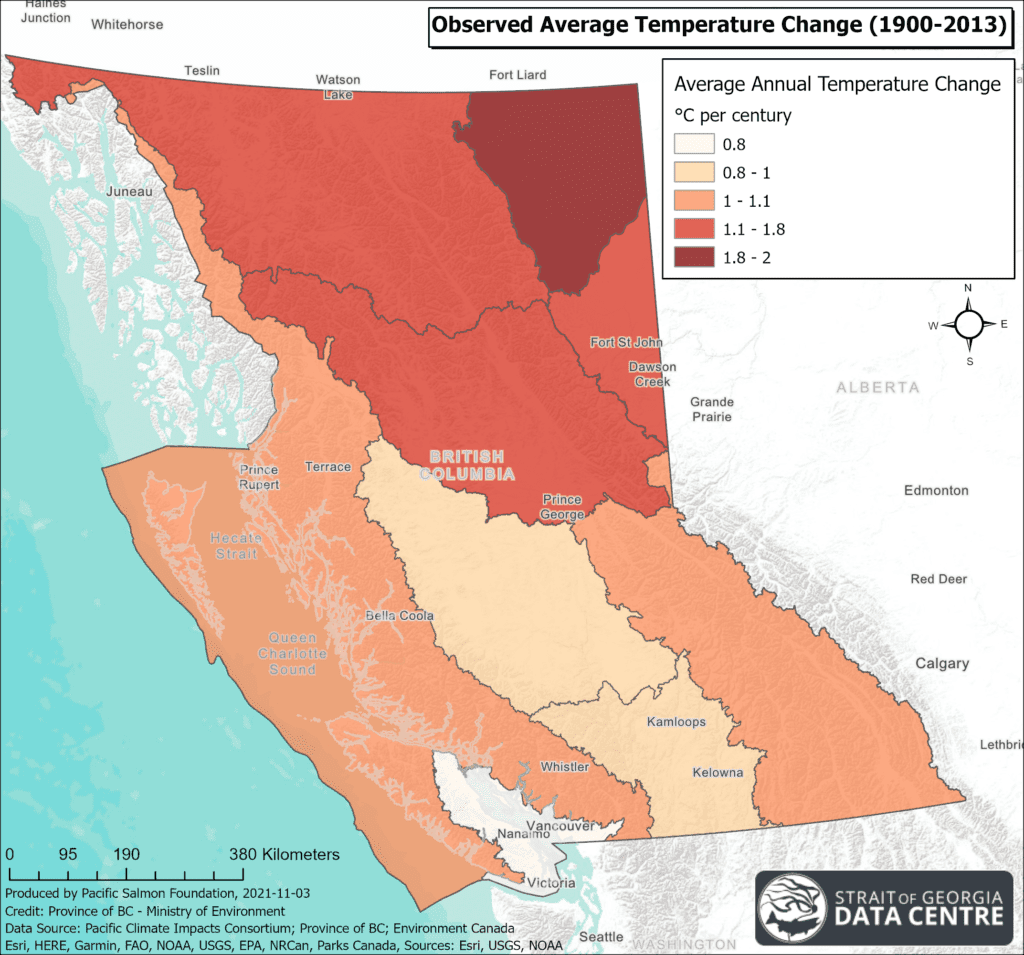
Air Temperatures are Increasing
In BC, the greatest increases in air temperatures have occurred in the central and northern parts of the Province, as seen on the map on the left. Air temperatures in the Eastern and Southern Vancouver Island regions have been relatively stable in the past, but are expected to become warmer and possibly more variable into the future.
Summer heat waves like the record shattering ‘heat dome’ event that blanketed an extensive area of the Pacific Northwest for a week will become more frequent and intense, especially in lower elevations and valleys.
Equally important to extreme heat waves are relatively warmer winter night-time minimum temperatures. In coastal areas there will be fewer days that dip below freezing except at higher elevations, which will have implications for our snowpack and river flows.
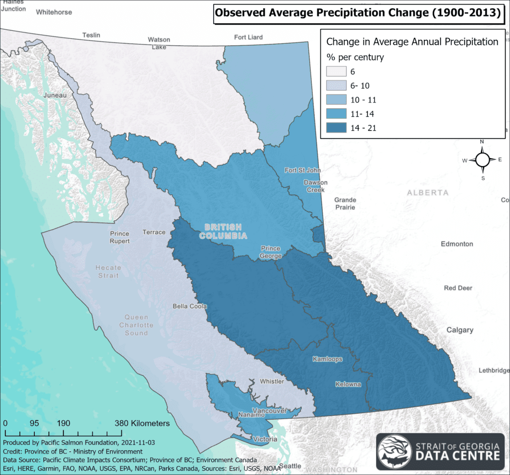
Precipitation Patterns are Changing
In the future it is projected that the cooler months will see more precipitation, but the summer will become drier. Already we are observing changes to precipitation as seen in the map, which shows an increase in average annual precipitation over the last 100+ years in BC, with the greatest increases being in the BC interior. The Georgia Depression has seen the greatest seasonal precipitation change with 23% increase during spring months. In winter, less precipitation will fall as snow due to warmer temperatures. This results in reduced snowpack in higher elevations and a loss of consistent melt waters that are so important to sustain streams through the dry season.
Increased precipitation in the fall and winter is likely to create more frequent high river flow and run-off events, particularly because less will fall as snow. This can cause overland flooding and erosion along rivers, which could threaten homes and other structures. Heavy winter rainfall also has the potential to destabilize slopes, which could trigger mass movement events like landslides, as well as lead to blockages of logs and other debris, causing rivers to overflow their banks. Higher flows will impact salmon habitats by lowering water clarity due to increased sediment inputs, scouring spawning gravel and threatening the stability of riparian vegetation that provide salmon shade, cooler waters and insect food sources. Stronger flows could potentially make migration much more difficult for Pacific salmon, and wash away salmon eggs from their redds (nests) in the gravel.
The Sea is Getting Higher, Warmer, and More Acidic
Sea Surface Temperature
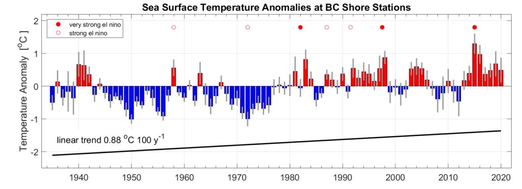
Long-term trends show that the sea surface temperatures have been increasing globally and the same is true along the BC coast. The rate of increasing sea surface temperature varies significantly by region around British Columbia. The increases have been most pronounced for the southern/inner coastal region where sea surface temperatures have been rising at a rate of 0.40°C per decade, whereas the temperatures in the northern/outer coastal region have been rising at 0.12°C per decade. If these trends continue, the sea surface temperatures in the Strait of Georgia may increase by 3°C by 2100.
Trend in annual sea surface temperature based on the observations of all lighthouses from the British Columbia Lightstation Network Dataset. representing inner and outer coast stations. The bars represent anomalies, averaged across all monitoring locations, from the long-term average temperature (1935-2020). Blue bars indicate below average temperatures for that year and red above average. Error bars indicate the variability between lighthouse data for each year. Figure, used with permission, appears in the State of Pacific Ocean Report (DFO).
Warmer sea surface temperatures from climate change on top of natural climate fluctuations increase the risk of events known as marine heat waves. During marine heatwaves, the thermal tolerances of marine species can be exceeded and result in stress or death. In the future, these are projected to increase in frequency, intensity, duration and spatial extent globally.
Warmer waters have been implicated in the loss of important habitats such as eelgrass meadows and kelp forests which are crucial to the life cycles of many species including salmon. Harmful algal blooms, biotoxins and disease outbreaks are also associated with warmer sea surface temperatures.
Ocean Acidification
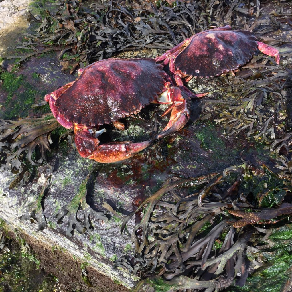
As part of the normal carbon cycle, ocean waters absorb a portion of CO2 from the atmosphere and this influences the pH of the water. With higher levels of CO2 in the atmosphere seawater is becoming more acidic. More acidic conditions make it more difficult for organisms that rely on calcium carbonate for their shells to form properly. This will challenge shellfish growers and many of our native shellfish species, including clams and crabs. Larval crab and other small crustaceans are vital to the food web and are an important food source for juvenile salmon!
Sea Level Rise
Sea level rise also varies by region due to a number of factors. In BC, sea level rise is projected to be greatest on the north coast, the Fraser Lowland and around southern Vancouver Island, ranging from 50 to 70cm by the year 2100 (median model change under RCP8.5; not accounting for the possibility of Greenland and Antarctic ice sheet disintegration). The rest of Vancouver Island is projected to experience a much smaller relative rise in sea level - mainly due to tectonic uplift. Generally sea levels have been rising at an accelerating rate as the oceans warm and ice sheet melt. Even at the modest end of this range, our coastlines as we know them will inevitably change.
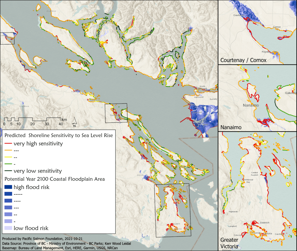
Maps depicting coastal areas shoreline sensitivity to sea level rise and flood risk along the Strait of Georgia. Degrees of sensitivity marked by red, amber, yellow, green and black in order from most to least sensitive. Areas that are projected to be vulnerable to coastal flooding by 2100 are shaded in blue. The 2100 coastal floodplain area dataset uses sea level rise and approximate flood construction levels (FCLs). It includes a nominal allowance for wave effects but does not account for river flooding effects nor a combination of these effects with sea level rise, the presence or absence of flood protection structures, and has not been ground truthed. Data are from the Province of BC and Kerr Wood Leidal.
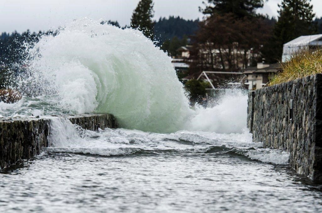
With higher sea levels and larger and more intense winter storms coming together, many areas of our coast will be at risk. Low-lying regions will experience more frequent flooding. By 2050, historical extreme flood events that occurred once per century, are projected to occurring on average at least once a year in many low-lying regions. Crashing waves hitting higher on the shoreline will cause increased erosion. Coastal bluffs will crumble at greater frequency than they had previously. Shorelines that have hard armour, like rip rap and seawalls, may be undercut causing them to fail. In many locations, accelerated erosion and flooding may damage culturally important places, threaten structures and impact intertidal habitats.
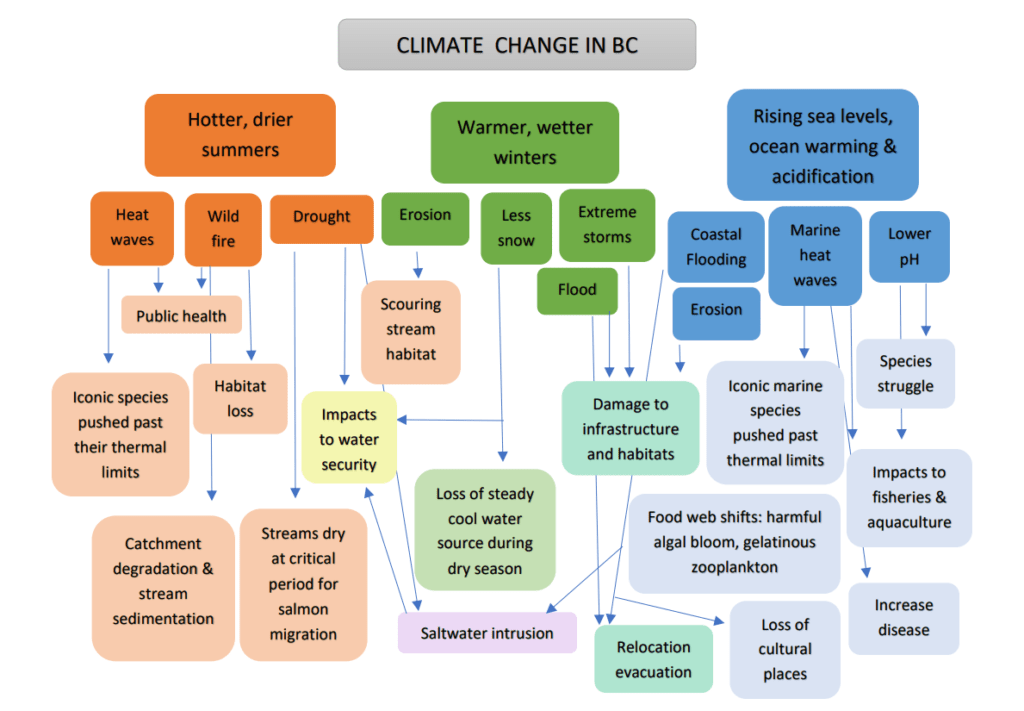
Cascading Impacts
In sum, climate change will cause a myriad of challenges for British Columbians to adapt to. Depicted below are the projected changes expected for British Columbia and the cascading impacts that they will cause. Together these impacts may result in shifting ecosystems, where certain species may become locally extinct or conditions become more favourable for other species to become dominant; altered ways of life for communities such as relocation away from flood prone areas or redesigning homes and infrastructure to cope with extreme heat and storms; challenges for primary industries of forestry, agriculture, fisheries and aquaculture in light of the increases to wildfires, reduced water security during the growing season and warmer, more acidic seawater; and places of cultural significance may be lost or altered along with ways of life that have been practised in BC for millennia.
Additional Resources
Learn more about the impacts of climate change and ways that BC can adapt in this Climate Change Backgrounder video made by the Province of BC.
Explore the tools on the Changing Coastlines web platform, including a visualization of climate change impacts on varying sectors under different coastal flooding scenarios. You can also find a backgrounder on practical strategies that can help us implement the ‘protect, retreat, accommodate, avoid’ approaches to coastal adaptation.
References for the information contained within this post:
Amos, C.L., Martino, S., Sutherland, T.F., and Al Rashidi, T. 2015. Sea Surface Temperature Trends in the Coastal Zone of British Columbia, Canada. Journal of Coastal Research 300: 434–446.
British Columbia Ministry of Environment (MOE). 2016. Indicators of Climate Change for British Columbia: 2016 Update. Ministry of Environment, British Columbia, Canada.
Capital Regional District (CRD). 2017. Climate Projections for the Capital Region.
IPCC. 2019. IPCC Special Report on the Ocean and Cryosphere in a Changing Climate. eds. Pörtner, H.O., Roberts, D.C., Masson-Delmotte, V., Zhai, P., Tignor, M., Poloczanska, E., Mintenbeck, K., Alegría, A., Nicolai, M., Okem, A. Petzold, J., Rama, B., and Weyer, N.M.
NOAA. 2017. Global and Regional Sea Level Rise Scenarios for the United States. NOAA Technical report NOS CO-OPS 083.
Oppenheimer, M., Glavovic, B.C., Hinkel, J., van de Wal, R., Magnan, A.K., Abd-Elgawad, A., Cai, R., Cifuentes-Jara, M., DeConto, R.M., Ghosh, T., Hay, J., Isla, F., Marzeion, B., Meyssignac, B., and Sebesvari, Z. 2019. Sea Level Rise and Implications for Low-Lying Islands, Coasts and Communities. In: IPCC Special Report on the Ocean and Cryosphere in a Changing Climate. (Eds.) Pörtner, H.O., Roberts, D.C., Masson-Delmotte, V., Zhai, P., Tignor, M., Poloczanska, E., Mintenbeck, K., Alegría, A., Nicolai, M., Okem, A. Petzold, J., Rama, B., and Weyer, N.M.
Philip, S.Y., Kew, S.F., van Oldenborgh, G.J., Yang, W., Vecchi, G.A., Anslow, F.S., Li, S., Seneviratne, S.I., Luu, L.N., Arrighi, J., Singh, R., van Aalst, M., Hauser, M., Schumacher, D.L., Marghidan, C.P., Ebi, K.L., Bonnet, R., Vautard, R., Tradowsky, J., Coumou, D., Lehner, F., Wehner, M., Rodell, C., Stull, R., Howard, R., Gillett, N., and Otto, F.E.L. 2021. Rapid Attribution Analysis of the Extraordinary Heatwave on the Pacific Coast of the US and Canada June 2021. World Weather Attribution.
Photo credits: Jonathan Ford on Unsplash, Isobel Pearsall; Map Credit: Strait of Georgia Data Centre