Resilient Coasts for Salmon is part of the PSF
Marine Science Program
Monitoring shorelines allows waterfront homeowners and property managers to keep track of changes to the shoreline and adjacent property and to see how restored shorelines respond to storms. Restoration professionals recommend monitoring before and after any development or restoration to evaluate the effectiveness of restoration efforts, to observe ecological change over time, and to determine if any site maintenance is necessary. This information can be used to adapt the design for better performance and revise its application in future projects. Monitoring can help identify erosion risks, track sediment loss, and assess the effectiveness of shoreline protection against rising sea levels and flooding.
Several scientific studies have monitored nature-based shoreline (NBS) designs to document how resilient these systems are to disturbance and how well they perform over time. For example, a study in Florida found that three living shorelines persisted through extreme weather events. They absorbed up to 28% of wave impact during hurricanes, and saw a five-fold increase in vegetated areas within two years of restoration. Similarly, monitoring of a living shoreline design in Mahone Bay, Nova Scotia, showed that the nature-based shore design withstood a tropical storm with minimal erosion. Of note, the storm washed out walking paths along the waterfront - except for the section protected by the living shoreline, which remained in excellent condition. One study found that a naturalized shoreline gained four times more sediment than it lost.
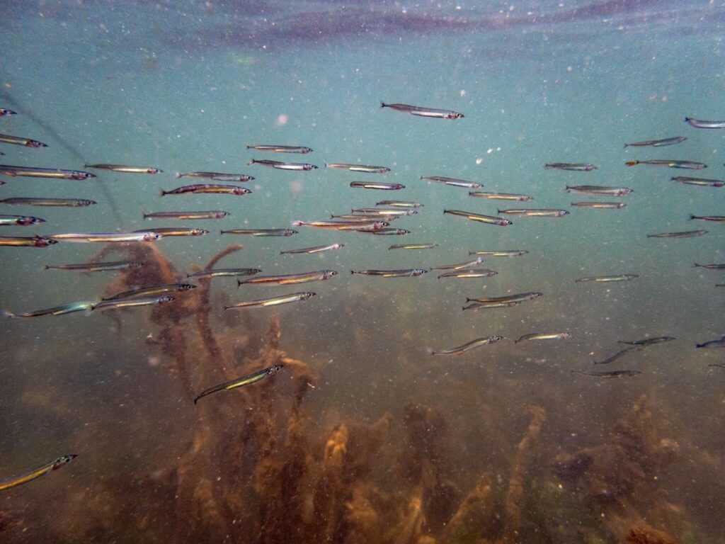
Monitoring has also shown how NBS designs can help remove excess nitrogen from the environment that might otherwise cause algal blooms; this protects the diversity and richness of aquatic organisms like shrimp and fish, benefiting ecosystem health and function (Onorevole et al., 2018; Shinn et al., 2025, Smith et al., 2024). Monitoring has also shown increases in native vegetation cover on restored shorelines, reductions in invasive plant density, and increased activity of native and at-risk wildlife on naturalized shorelines (Tower et al., 2023).
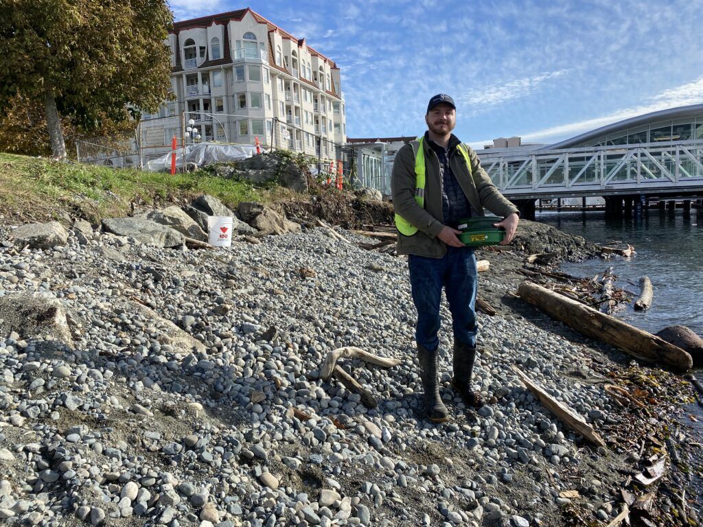
Photo credit: Kelly Loch
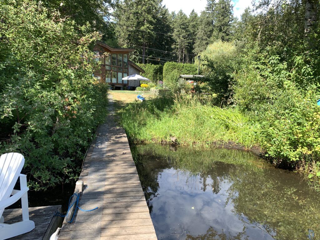
Waterfront homeowners can learn how to monitor their shoreline using the Green Shores for Homes Monitoring Guide, developed by the Stewardship Centre for BC and TransCoastal Adaptations: Centre for Nature-based Solutions as part of the Green Shores® program. This guide offers practical advice for both homeowners and professionals and can help develop long-term records to track the performance of nature-based solutions.
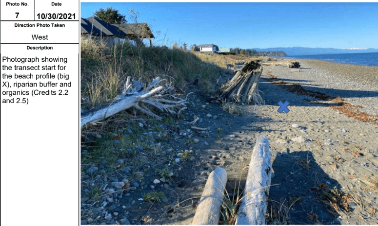
As a homeowner, you will find helpful “how-to” descriptions, checklists for shoreline maintenance and landscape activities, and notes on reducing water runoff and maintaining septic systems to protect the ecological integrity of the shoreline and adjacent aquatic environment. While some technical monitoring requires trained professionals (such as assessing habitat for species at risk or shoreline profile changes using specialized equipment), homeowners can perform other monitoring activities, such as taking photos at set viewpoints.
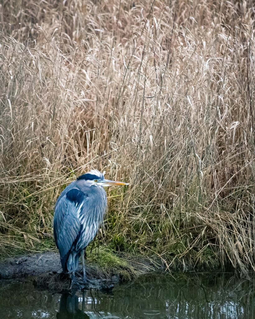
One of the exciting ways to note changes in the ecological function of your shoreline is by monitoring wildlife and migratory birds near your home. You might only need a pair of binoculars and a phone to observe wildlife and track your observations. You can make records in a document such as a spreadsheet or an app like iNaturalist or Merlin. By taking photos, you are helping create records that can be used to assess change over time, and joining a community of citizen scientists who can help identify what you find!

If you are looking to participate in more widespread monitoring, you can volunteer as part of the Coastal Forage Fish Monitoring Network (CFFN). Depending on your location, you can volunteer with the following organizations, who are part of the CFFN: Project Watershed, Peninsula Streams and Shorelines, and MABBRI, among others!
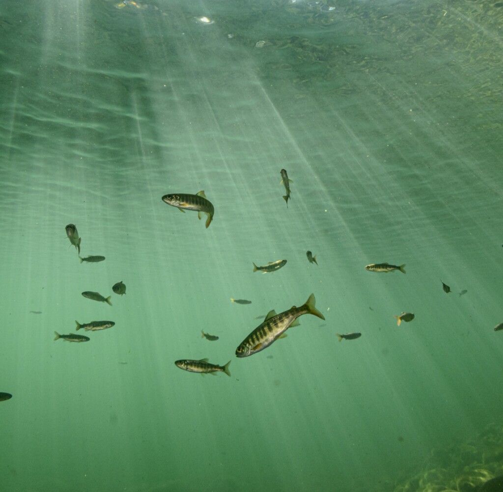
Photo Credit: Jake Dingwall
Taking pictures from the same location across years is a great way to document vegetation growth, beach erosion and impacts of extreme weather events.
We recommend taking photos of your site:
1) before restoration,
2) after completing restoration and
3) at periodic intervals in the future.
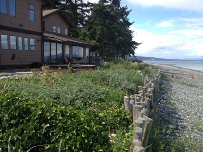
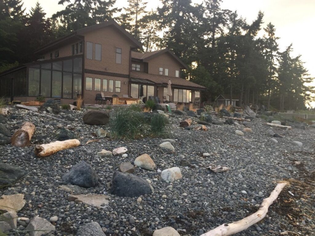
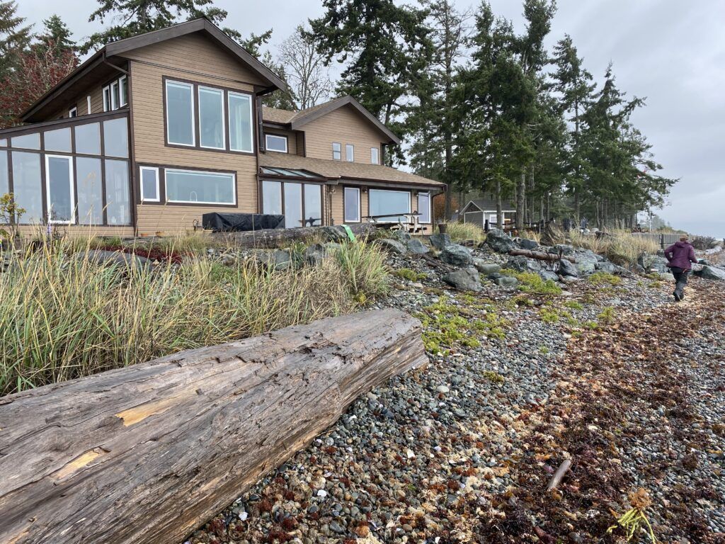
The gallery above is an example of photo point monitoring of a Green Shores for Homes project in Qualicum bay, B.C. The photo on the left was taken before Green Shores for Homes nature-based restoration; the photo in the middle was taken just after restoration was completed in 2016; and the photo on the right was taken as part of monitoring of 2022. Monitoring with photos helps to document changes n native plant growth, as well as changes in the accumulation of sediment and organic material on the shoreline. Photos by Kelly Loch, Stewardship Centre for B.C.
The Resilient Coasts for Salmon project is developing monitoring plans for three Green Shores for Shoreline Development demonstration projects on Vancouver Island: Songhees Walkway Pocket Beach, Dyke Road Park, and Esquimalt Gorge Park. The Songhees Walkway will be the first site to undergo monitoring, and results will be shared with the public. To stay updated on shoreline monitoring efforts and project developments, sign up to receive the Resilient Coasts for Salmon e-news updates.
Monitoring shorelines is key to successful restoration efforts, improving coastal resilience, and protecting ecosystems. By tracking changes over time, homeowners and professionals can ensure that nature-based solutions remain effective, adapt to environmental shifts, and support biodiversity. The Resilient Coasts for Salmon project highlights the value of ongoing shoreline monitoring, providing data that strengthens restoration practices and benefits both communities and wildlife. With simple tools like the Green Shores for Homes Monitoring Guide, everyone can play a role in preserving healthy shorelines for the future.